EUROPA
Europa es un pequeño continente que tan sólo ocupa el 7% de las tierras emergidas. Está situado en el hemisferio norte, tiene unas características naturales y climáticas que son
especialmente favorables para la vida humana. Por eso es un continente
muy poblado.

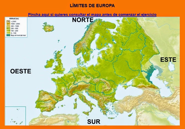
LÍMITES
AL NORTE:
OCÉANO GLACIAR ÁRTICO.
AL SUR: MAR MEDITERRÁNEO, MAR NEGRO Y EL CÁUCASO.
AL OESTE: OCÉANO ATLÁNTICO.
AL ESTE: MONTES URALES Y
MAR CASPIO.


EUROPA FÍSICA
PUNTOS DE INTERÉS GEOGRÁFICO
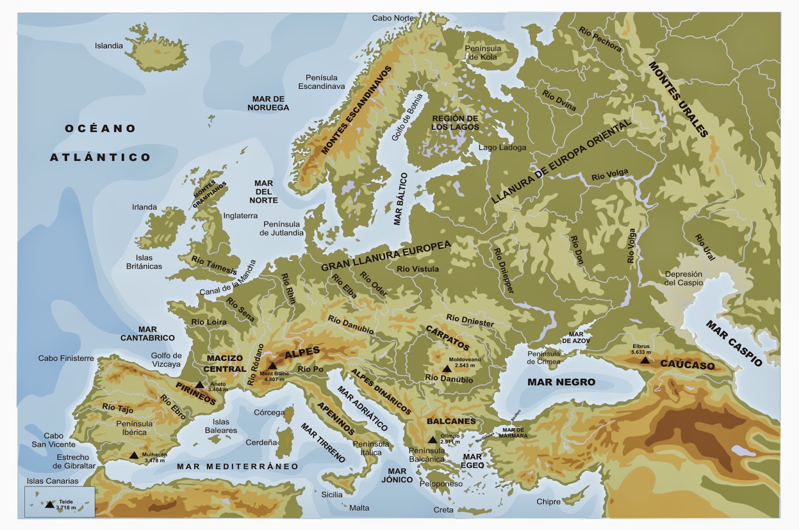

RELIEVE
En el centro
del continente predominan las llanuras, la Gran Llanura Europea se extiende
desde Francia hasta los montes Urales. En su interior hay algunos macizos
montañosos y algunas mesetas.
En el norte y sur del continente predominan las zonas
montañosas.
Los ríos son más cortos que
en otros continentes.
Costas muy recortadas por ese motivo abundan las
penínsulas, los golfos y las islas.
CORDILLERAS: Cáucaso
(Elbrus), Alpes (Mont Blanc), Cárpatos, Balcanes, Apeninos y Pirineos.
MONTES MÁS ALTOS: Elbrus (Rusia) con 5.642 m,
el Shkhara (Georgia) con 5.204 m y el Mont
Blanc (Francia) en Europa occidental con 4.807 m.
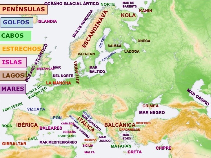
PENÍNSULAS: Escandinavia, Ibérica, Itálica y Balcánica, además de las penínsulas de Kola (Rusia), Jutlandia (Dinamarca), Bretaña (Francia) y Crimea (Ucrania).
CABOS DE
EUROPA: CABO NORTE, CABO DE FISTERRA, CABO DA ROCA, CABO DE SAN VICENTE, CABO DE
MATAPÁN.
GOLFOS DE
EUROPA: GOLFO DE BOTNIA, GOLFO DE FINLANDIA, GOLFO DE VIZCAYA, GOLFO DE CÁDIZ, GOLFO DE VALENCIA, GOLFO DE LEÓN,
GOLFO DE GÉNOVA.
ACTIVIDADES INTERACTIVAS SOBRE EL RELIEVE


 |
| CADENAS MONTAÑOSAS DE EUROPA |
 |
| PENÍNSULAS DE EUROPA |
 |
| ISLAS DE EUROPA |

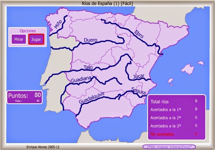
RÍOS DE EUROPA


VERTIENTES DE EUROPA
Vertiente ártica: son ríos con abundante caudal en primavera y en otoño , pero permanecen helados en invierno. Destacan el río Dvina Septentrional y el Pechora.
Vertiente atlántica: son ríos muy caudalosos, ya que reciben
precipitaciones abundantes todo el año. Destacan los ríos Dvina Occidental,
Vístula, Oder, Elba, Rin, Sena, Loira y Tajo.
Vertiente mediterránea: son ríos irregulares y de escaso caudal por la falta de lluvias. Los más importantes son el Ebro, el Ródano y el Po.
Vertiente del mar Negro. En este mar desembocan algunos de los ríos más largos de Europa, como el Don, el Dniéper y Danubio.
Vertiente del mar Caspio. En este mar desembocan el Volga, que es el más largo del continente, y el Ural.


ACTIVIDADES INTERACTIVAS SOBRE RÍOS


CLIMAS
ENLACE: MUCHA INFORMACIÓN SOBRE EL CLIMA Y ZONAS CLIMÁTICAS. ACTIVIDADES INTERACTIVAS

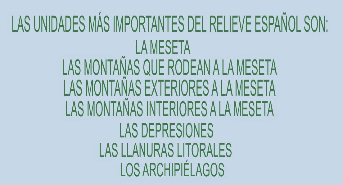
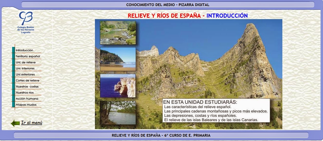
RELIEVE DE ESPAÑA


 |
| LOS RÍOS DE ESPAÑA Y DE EXTREMADURA |


CAZAS DEL TESORO
RECURSOS:


No hay comentarios:
Publicar un comentario